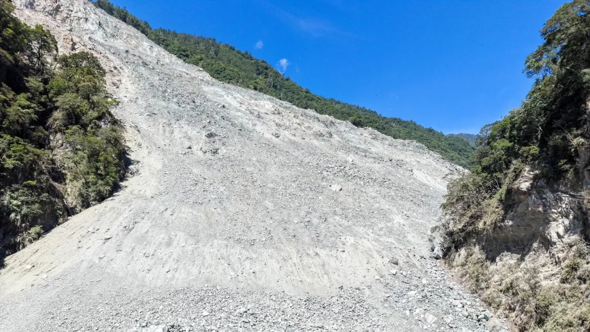
On August 26, 2026, shortly after 8:37 a.m., a slab of rock and glacier ice broke off the north face of Langtang Lirung, a 7,227-meter peak in Nepal's Rasuwa district near the Chinese border. The front of the flow it became averaged about 190 kilometers per hour over its first 22 kilometers. Nepal's flood forecasting division sent text alerts to some 679,000 people 38 minutes after the collapse; Timure, the settlement nearest the border, had less warning time than anywhere downstream and went under. By September 12, 1,429 people were confirmed dead across Nepal and Tibet and 5,649 were still missing. Nepal's national planning commission and its disaster authority put the rebuilding bill at US$4.73 billion.
Eastern Taiwan saw its own version coming for two months, and it was not enough. A landslide dammed Matai'an Creek above Hualien County on July 25, 2025; Taiwan's forestry agency flew 17 surveys over the lake that formed, and 8,524 people were ordered out before it failed on September 23. Nineteen people died and five are still missing. Of the first 14 victims identified, 13 were over 60, most drowned on the ground floors of their own homes, and every one of them was inside the evacuation zone. A year on, Storm Media returns to Guangfu, where about 236 million cubic meters of sediment still hangs above the town. This is Part 2 of a three-part series.
Three excavators are still parked in the mountains above Guangfu, a township in eastern Taiwan, a year after the flood that killed 19 people there. They cannot be driven out. Every few days someone climbs up to start their engines, refuel them and service them, so that they will run if the slope moves again.
They are the most literal accounting of what the disaster left behind. Six went up the creek bed after the barrier lake burst, crawling for a full day over broken ground and cutting their own road through collapsed sections. Three were buried by moving sediment. Their operators got out in time. The other three could not be withdrawn and have stayed where they stopped.
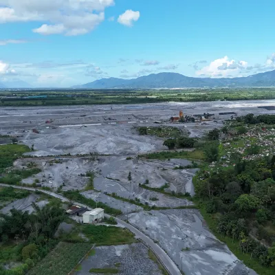
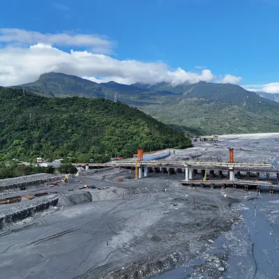
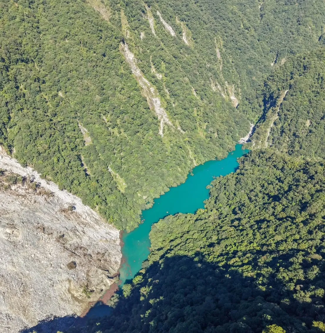
The lake itself is gone; the water drained and the channel returned. What did not go anywhere is the material. Taiwan's Forestry and Nature Conservation Agency, through its Hualien branch, puts what remains in the remnant dam, the collapse deposit on the left bank of the old overflow outlet and the channel at about 236 million cubic meters. For comparison, dredging has removed about 25 million cubic meters from the riverbed downstream since the disaster.
Six Excavators Went Up. Three Never Came Down.
Huang Cheng-hsien coordinated much of the movement in and out of the collapse zone. He is a buckwheat farmer in Yuli, further down the valley, and he leads the East Taiwan Search and Rescue Team, a volunteer outfit that began as a group of friends who liked canyoning and mountain walking and became, over years of being asked, the people Taiwan's fire service calls when someone falls into a gorge.
When the barrier lake formed on Matai'an Creek, he organized two routes into the upper catchment, one following an old forest road. Sections had to be rappelled. The first assessment trips were expected to take eight or nine days round-trip. He stayed outside to coordinate on the first attempt and walked in himself on the second, once the weather steadied.
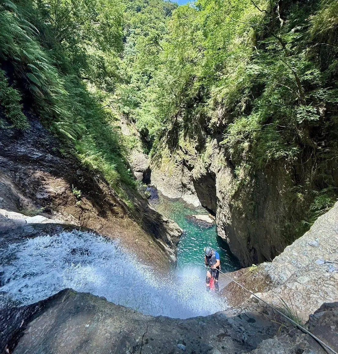
What he found was not a small blockage. The failure ran more than a kilometer along the mountainside. The dam was wide, the debris field long, and the standard responses — blasting, mechanical excavation from below — became close to unusable. Anyone working beneath the dam would have no time to escape if the water behind it let go.
It let go on September 23. By around midday, Huang said, monitoring data suggested the dam had perhaps 30 minutes to an hour left. They knew the water was coming. They did not expect what it would do when it reached the town.
"Everyone knew it would collapse," he said. "Nobody thought the consequences would be that big." Taiwan gets landslide dams regularly, he noted, and most are small and overtop harmlessly within days. Experience said this would be another one.
Huang Cheng-hsien Says the Mountain Keeps No Clock
Earthquakes release accumulated energy, which is why engineers can speak of a hundred-year event. Slopes do not work that way. Quakes and heavy rain raise the probability, but what actually decides when a mountainside loses its footing includes the rock itself, how much water is in it, where the fractures run and how long the base has been scoured.
"Nobody can predict when a mountain is going to come down," Huang said. He compared it to a wheel with no fixed stopping point: it could be every three to five years, or once a century, or today and again tomorrow.
That is why he thinks arguing about levee height alone misses the problem. Whether the slopes are still failing, how much sediment the bed has gained, how much the next storm will move and whether the channel shifts are all questions that need continuous data. A barrier lake draining means one body of water is gone. The landscape that produced it is still moving.
Guangfu Sits in an Old Riverbed
Matai'an Creek has carried heavy sediment loads for as long as anyone has measured it. Once embankments confined that material to the channel, the bed began to rise. The town center was built on the creek's former course, on what had been marshland, a little over a century ago — and unlike the riverbed, a town does not rise.
The result is what Taiwanese engineers call a perched river: the channel now sits close to, or above, the settlements on either side. Inside the levees it looks safe. Over them, or through a breach, the water runs downhill into the town and the fields.
Huang draws a distinction that mapping alone does not capture. Nearby Wanli Creek winds, and its bends bleed energy before it reaches anywhere populated. Matai'an runs straighter, from slopes that have been eroding for decades, straight at Guangfu. Both can form barrier lakes. They do not carry the same risk to the places below them.
The Mud the Volunteers Cleared Became Dust
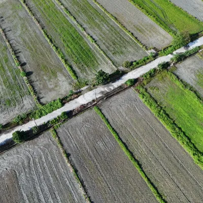
The most striking thing in Guangfu now is not the flood line. It is the spoil. Everything the volunteers, soldiers and machines dug out of houses, schools and roads was trucked to three holding sites: beside Taiwan's Provincial Highway 9, at Atomo on the south bank, and near Fenglin on the north. The pile along the highway is roughly 50 meters wide, four or five stories high and nearly a kilometer long, covered in blue tarpaulin. Six months after the flood, officials estimated the three sites held close to a million metric tons.
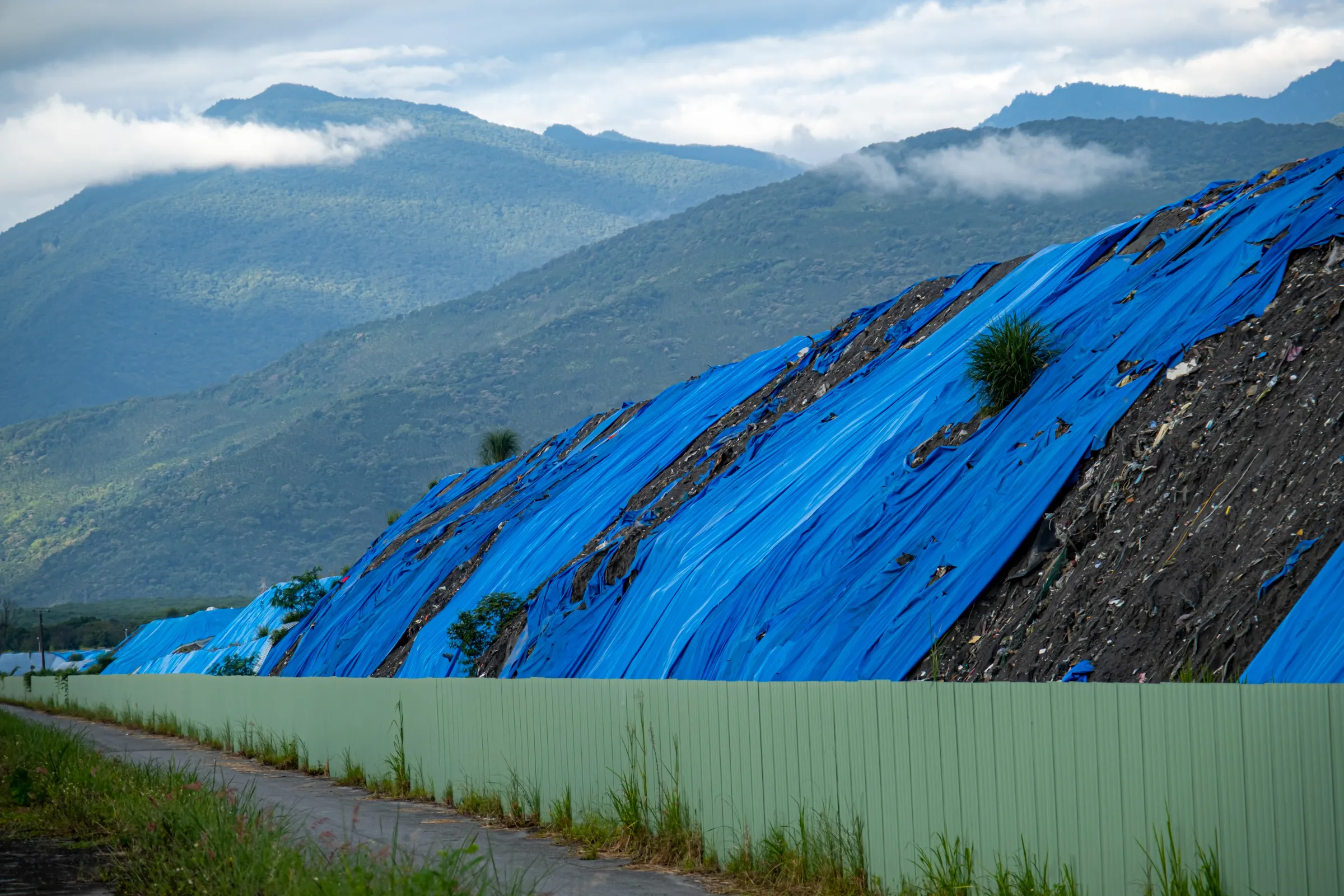
Once the fine silt dries, the problem changes from disposal to air. Residents say a freshly washed car is coated again in two days, and that drizzle lands as small mud spots. Guangfu Vocational High School principal Chen Te-ming said staff hesitate to open classroom windows and that shoes and desks collect dust daily. At Guangfu Junior High, principal Huang Chien-jung said meal service now has to be protected from blowing sand.
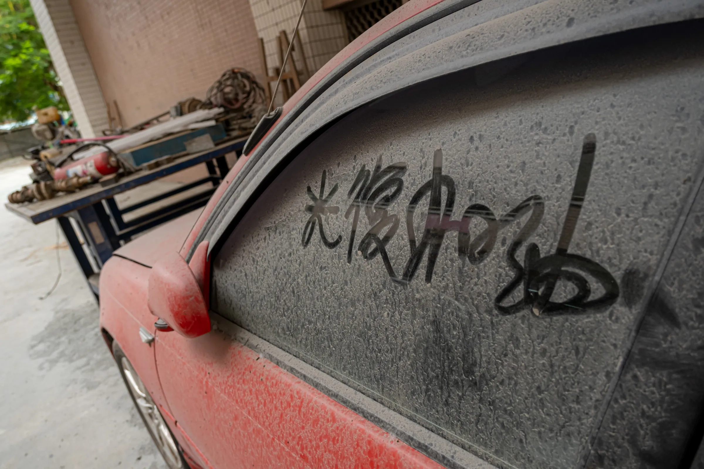
There is no sustained, published monitoring of what that dust is doing to residents' airways. The highway pile is at least sheeted; the other sites and the wide riverbed are not. Southwesterly winds carry it north in summer, the northeast monsoon carries it south in winter, and it travels the valley toward Fenglin and Ruisui.
Warnings Now Arrive More Often Than Danger
The other thing the disaster left is alarms. In 2026 a new barrier lake formed above Wanli Creek, red alerts were issued several times, and some residents were out of their homes for more than 10 days. Phones now sound as cars — and trains — cross the two creeks. Residents have begun to lose track of which alert means what, and what they are supposed to do about it.
Huang's assessment is that the monitoring is no longer the hard part. Satellites compare terrain, drones fly the site and photograph cracks and water levels, and people go in to verify when it matters. Taiwan's forestry agency tracks the lake daily by drone precisely so the three excavators can start digging at short notice.
The hard part is turning that into something a person will act on. Guangfu has two lessons to offer, he said: residents now move when they hear "barrier lake," and agencies now treat new ones seriously. Both were bought with 19 deaths and five people still missing. What is still missing is an alert that says when the danger arrives, which places it reaches, and where to go. (Related: Taiwan's Landslide Dam, One Year On 1 | 200 Hectares Marked, No One Asked the Village | Latest )
Telling people there is a lake on the mountain, he said, is not enough to get them past their own experience.